Point cloud to CAD: how it works and what you get
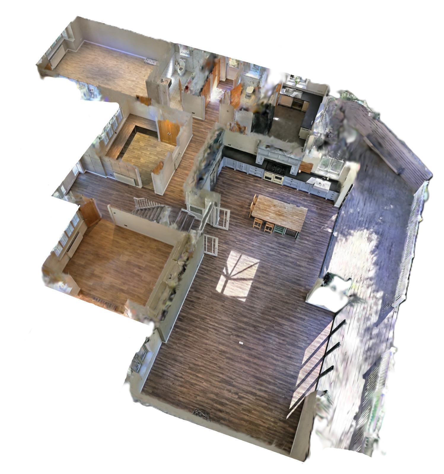
If you design or work on existing buildings, you already know the pain: measuring a site by hand is slow, and one wrong dimension can cost you dearly further down the line. A 3D scan removes that risk — you draw and model from the real building, not from a tape measure and a hopeful sketch. Here’s how the point cloud to CAD process actually works, and what you get at the end.
What is a point cloud?
A point cloud is a set of millions of measured points that together describe a space in 3D. We capture it with a LiDAR scanner (the Xgrids PortalCam), which records the position of every surface — walls, floors, ceilings, pipework, the lot — along with colour from photography. The result is an accurate, measurable 3D record of the building exactly as it stands today.
From scan to CAD, step by step
- Capture — we walk the site with the scanner, indoors and out, capturing the whole space in a single visit.
- Register & clean — the raw scan is processed into one aligned, tidy point cloud.
- Export — we deliver it in the format your software expects (more on that below).
- Draw or model — you bring the cloud into your CAD or BIM package and work straight from it: trace 2D plans, sections and elevations, or model the building in 3D.
That last step is the point: you’re no longer working from assumptions. Every line you draw is anchored to the real, measured building.
The file formats you’ll get
We supply whatever suits your workflow, including:
- E57 — the open, software-neutral standard that imports almost anywhere.
- LAS / LAZ — common for survey and GIS workflows.
- RCP / RCS — Autodesk ReCap, for a smooth path into AutoCAD, Revit and Civil 3D.
- PTS / PLY — widely supported point formats.
Tell us your software and we’ll match the export to it.
What you can do with it
- 2D drawings — accurate floor plans, sections and elevations traced directly over the cloud.
- Scan-to-BIM — model the building in Revit or ArchiCAD against as-built reality, ready for refurbishment or extension design.
- As-built records — a permanent, dimensioned snapshot of the building for handover, insurance or facilities management.
- Coordination & clash detection — check proposed services and structure against what’s really there.
How accurate is it?
Accurate enough for the job — and the right accuracy depends on the job. For as-built records, refurbishment and design work, a mobile LiDAR scan gives you dependable, real-world geometry far faster than manual measuring, and without the gaps a tape measure leaves behind. If your project needs a specific tolerance, tell us up front and we’ll advise on the best approach.
Who it’s for
Architects, building surveyors, structural and MEP engineers, and anyone who needs to design or report against an existing building. If you’ve ever had to go back to site for “just one more measurement,” this is for you.
Getting started
Send us the building type, rough size, location and the software you work in. We’ll capture it in a single visit and hand back a clean, CAD-ready point cloud — usually within a few days.
GB3D is based in Haywards Heath and covers Sussex, Surrey and the South East, with UK-wide coverage for larger projects.
- Point cloud
- CAD
- Scan-to-BIM
- Surveys
Want a 3D scan, survey or a bespoke app?
GB3D serves Sussex, Surrey & the South East. Tell us about your project.
Get in touch